In Pictures: A city living under an active volcano

Antigua is Guatemala’s most popular destination – but the picturesque city sits on an active tectonic zone. Travel photographer Bella Falk captures a slice of life.
A

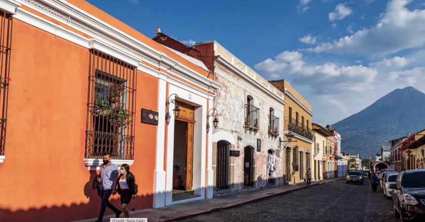
Antigua, Guatemala, is a Unesco World Heritage city and the jewel in the country’s crown. Smaller, safer and much less gritty than the capital, Guatemala City, Antigua is renowned for its picturesque streets lined with rainbow-painted colonial buildings, grand historic churches and convents, and a thriving cafe and restaurant scene.
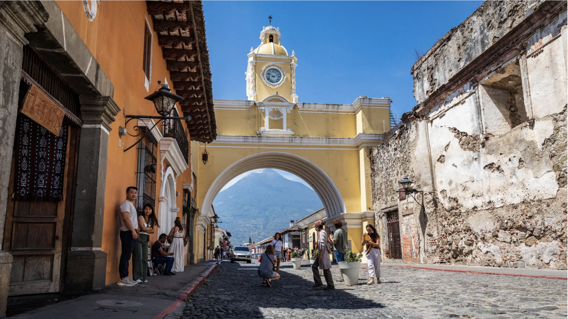
Antigua’s most famous landmark is the canary-yellow Santa Catalina arch, which dates to 1694. It was built to enable the nuns of the closed order of Santa Catalina to cross from their convent to the school on the other side of the street without being seen in public. Today it’s the most photographed monument in the country and an icon of Guatemala.
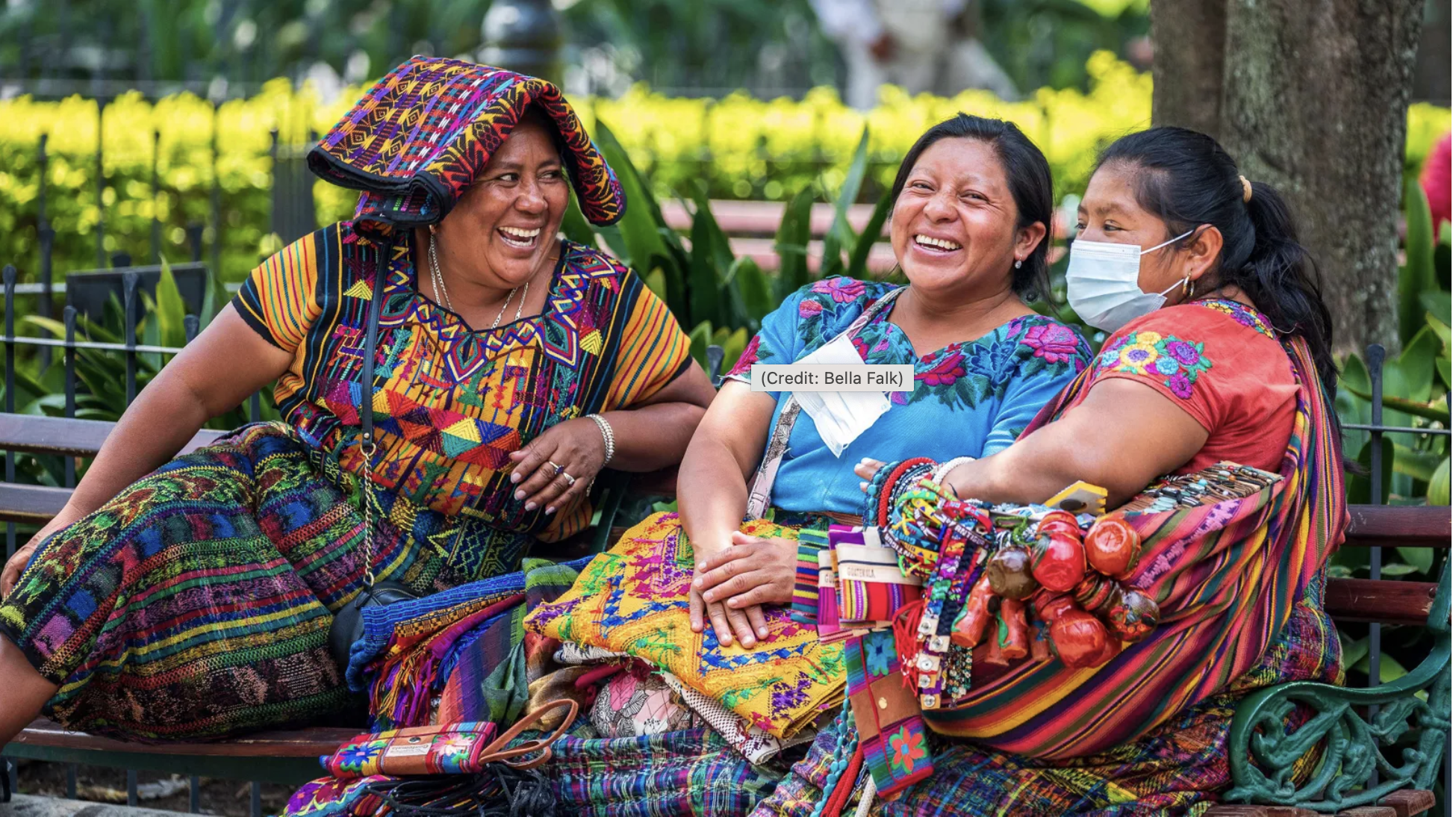
Antigua’s Central Park is the beating heart of the city. Enclosed on all four sides by elegant colonnades and 18th-Century buildings, it’s a lively square where locals come to meet friends and relax. Here you get a clear sense of Guatemala’s fusion of cultures: Indigenous Maya in traditional dress sit alongside denim-clad Guatemalans of European descent and visitors from around the world.
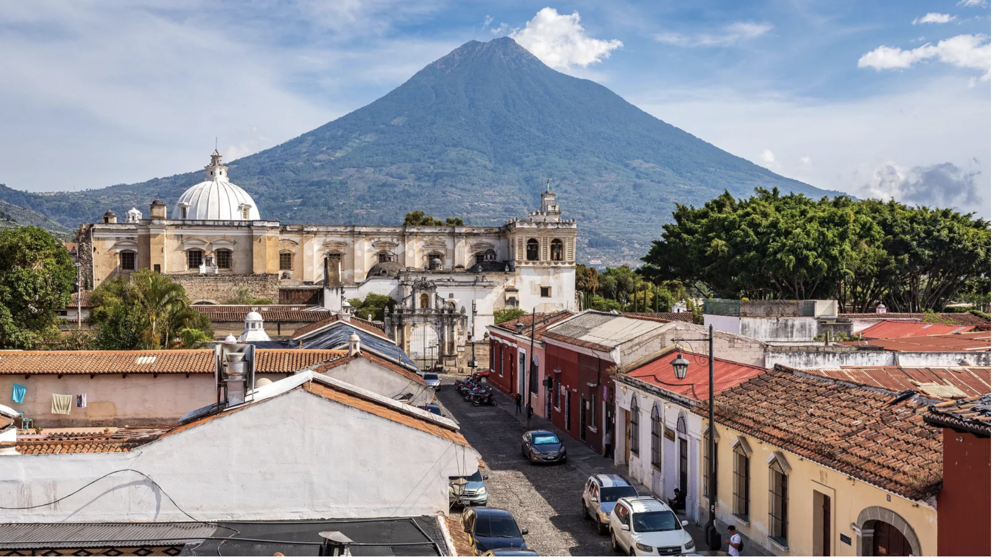
Until the 18th Century, Antigua, then known as Santiago, was Guatemala’s capital and one of the greatest cities in the Spanish Empire. But the city sits on an active tectonic zone in the vicinity of four volcanoes: Agua, Fuego, Acatenango and Pacaya. In 1773, it was devastated by a major series of earthquakes, so the government decided to move the capital to its current location and the city became known as La Antigua Guatemala (The Old Guatemala).
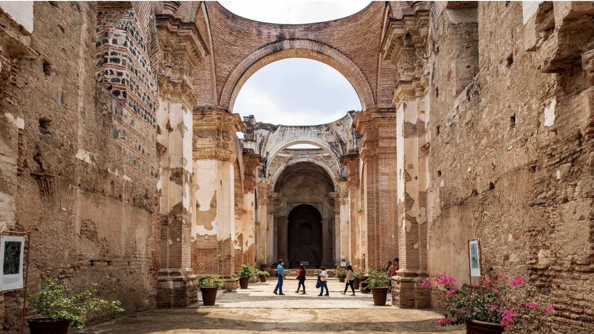
One of the hardest hit buildings was the magnificent former cathedral. Constructed in 1545, it stood for more than 200 years before being toppled by the earthquake. Today its roof is open to the elements, the collapsed remains of pillars and carvings are piled in the eerie side chapels and pigeons nest in the alcoves.
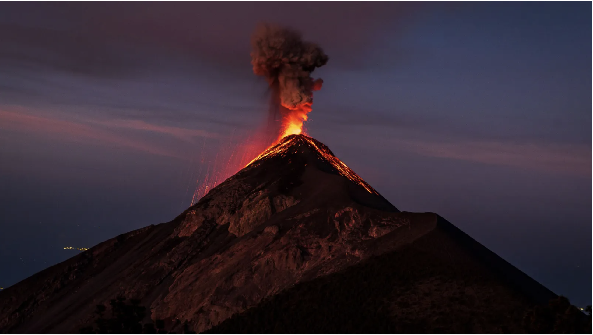
Now Antigua’s enemies have become its friends: those same volcanoes that wreaked so much damage are major tourist draws. The star attraction is the 3,768m-tall Volcan de Fuego (Volcano of Fire), one of the world’s most active. It has been constantly erupting since 2002, shooting incandescent lava bombs and clouds of ash into the air about every 15-30 minutes.
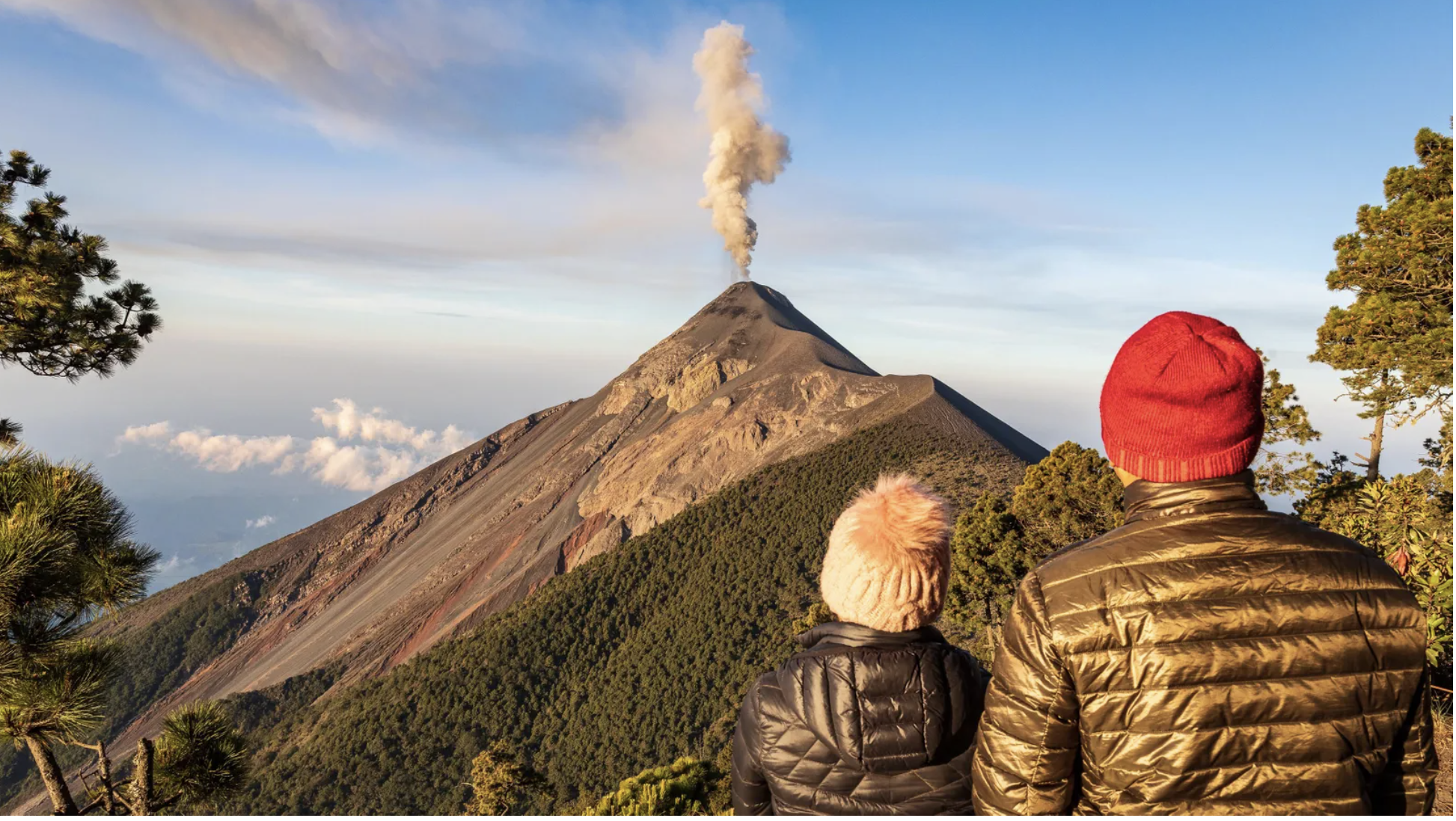
Visitors who want to witness Earth’s unstoppable power first-hand can hike up Volcan Acatenango, which stands right next to Fuego. Here, local tour companies offer overnight camping, so you can stay up late with a front-row seat to the action as Fuego explodes its red-hot guts into the night sky.
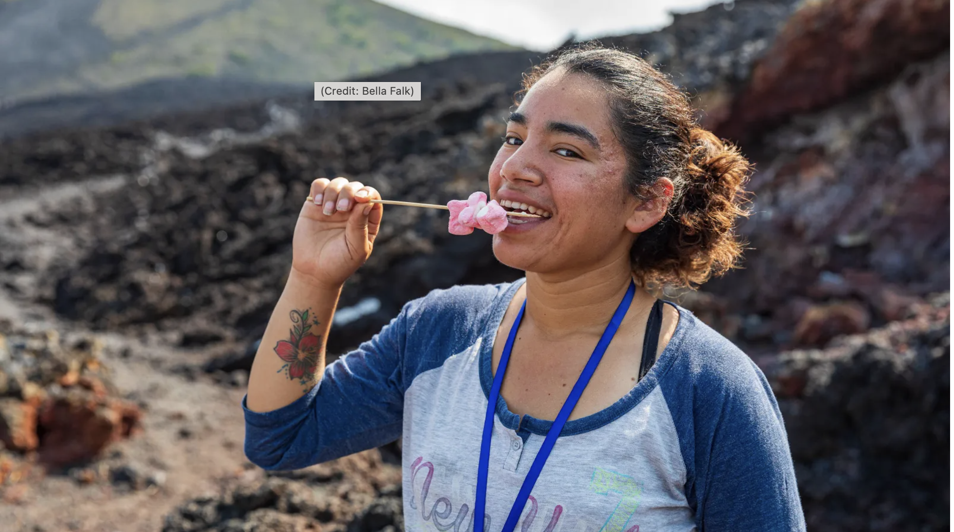
Another agent of destruction-turned tourist attraction is Pacaya, about 50km from Antigua. Until 2021, it also erupted frequently, oozing sticky lava down its slopes. Today the eruptions have stopped, and guides like Rubi Santamaria take visitors to the freshly dried lava field, where she shows them how to toast marshmallows using the volcano’s heat.

Guatemala: Heavy rainfall causes flooding and landslides near Fuego Volcano as of early Aug. 29

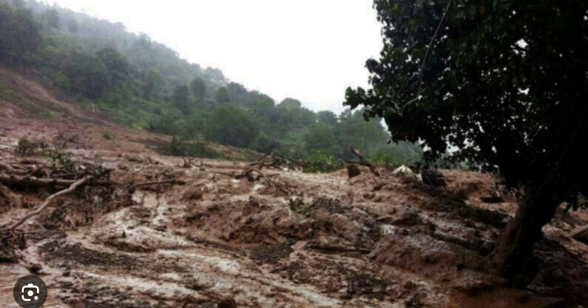
Heavy rainfall causes flooding and landslides near Fuego Volcano, Guatemala, as of early Aug. 29. Communities isolated.

Event

Heavy rainfall since late Aug. 27 has resulted in localized flooding and landslides near Fuego Volcano as of early Aug. 29. The landslides have isolated the communities of San Pedro Yepocapa and Escuintla. Further heavy rainfall could lead to additional flooding and landslides as well as hamper recovery efforts.

Transport
Flooding could block regional rail lines; freight and passenger train delays and cancellations are possible in areas that see heavy rainfall and potential track inundation.

Floodwaters and debris flows may render bridges, rail networks, or roadways impassable, resulting in overland travel disruptions in and around affected areas. Ponding on road surfaces could cause hazardous driving conditions on regional highways. Authorities could temporarily close some low-lying routes that become inundated by floodwaters. Severe weather could also trigger flight delays and cancellations at airports across the affected region.

Localized business disruptions are likely in low-lying areas; some businesses might not operate at full capacity because of flood damage to facilities, possible evacuations, and employees’ inability to reach work sites. Disruptions to electricity and telecommunications services are also possible where significant flooding impacts utility networks. Residual disruptions are likely once flooding has subsided as authorities work to clear debris and any flood damage.

Advice

Monitor local media for weather updates and related advisories. Confirm all transport reservations and business appointments before travel. Allow extra time for travel in the affected area and plan alternative routes if necessary. Do not drive on flooded roads.

Resources

National Institute of Seismology, Volcanology, Meteorology and Hydrology of Guatemala